


5:33 p.m.: A severe thunderstorm warning in effect until 6 p.m. for Haxtun, Holyoke and Paoli threatens winds of up to 50 mph and quarter-sized hail.
Severe Thunderstorm Warning including Holyoke CO, Haxtun CO and Paoli CO until 6:00 PM MDT pic.twitter.com/ZkqcpIUTjW
— NWS Boulder (@NWSBoulder) April 25, 2024
5:19 p.m.: A severe thunderstorm warning in effect until 5:45 p.m. for Haxtun threatens winds of up to 60 mph and quarter-sized hail.
Severe Thunderstorm Warning including Haxtun CO until 5:45 PM MDT pic.twitter.com/Rlf6HCJS7A
— NWS Boulder (@NWSBoulder) April 25, 2024
5:04 p.m.: A severe thunderstorm warning in effect until 5:30 p.m. for Holyoke and Paoli warns of the potential for winds of up to 50 mph and quarter-sized hail.
Severe Thunderstorm Warning including Holyoke CO and Paoli CO until 5:30 PM MDT pic.twitter.com/JrIxMYx2Eu
— NWS Boulder (@NWSBoulder) April 25, 2024
4:23 p.m.: A severe thunderstorm warning in effect until 4:45 p.m. for Logan and Washington counties threatens winds of up to 50 mph and quarter-sized hail. The warned area is between Fleming and Otis.
Severe Thunderstorm Warning including Logan County, CO, Washington County, CO until 4:45 PM MDT pic.twitter.com/HmuLdg21K7
— NWS Boulder (@NWSBoulder) April 25, 2024
Update 2:45 p.m.: Tornadoes, damaging winds and 2-inch hail are possible on Colorado’s Eastern Plains this afternoon, according to National Weather Service offices in Pueblo and Goodland, Kansas.
Forecasters issued a tornado watch at 2 p.m. for Cheyenne, Kit Carson, Phillips, Washington and Yuma counties until 9 p.m.
Hail up to 2 inches in diameter; damaging thunderstorms and wind gusts; and strong, possibly long-lived tornadoes are possible, according to the agency’s Goodland office.
A severe thunderstorm watch for east Kit Carson County predicted up to 60 mph winds and half-dollar-sized hail until 3:30 p.m.
Rapid thunderstorm development is possible along the far Eastern Plains until 5 p.m., including in Prowers, Kiowa, Bent and Baca counties, NWS Pueblo forecasters said in a post on the social media site X.
Hail up to 1 inch and wind gusts up to 65 mph are possible.
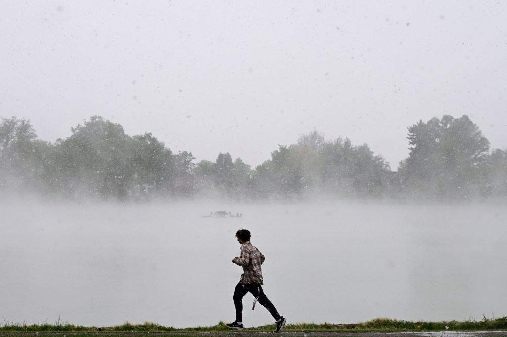
Original reporting: Foggy conditions are impacting morning commuters Thursday morning before afternoon thunderstorms will kick off a rainy weekend for the metro area, according to National Weather Service forecasters.
Thick fog was reported in several spots along Interstate 70 east of Limon, and around Denver International Airport Thursday morning, NWS meteorologists said.
The fog is expected to clear out by late morning, but will be replaced with afternoon and evening thunderstorms, according to NWS forecasters.
Scattered rain showers and isolated thunderstorms will move along the Interstate 25 Corridor this afternoon and evening, and Denver can expect the strongest waves of the incoming storm to hit between 5 p.m. Thursday and 3 a.m. Friday, forecasters said.
While the city will likely only see rain and lightning, eastern Colorado will need to watch out for large hail and possible tornados, according to a NWS hazardous weather outlook.
The main threat of severe weather conditions runs mostly east of Akron and Sterling, but there is some risk as far west as Fort Morgan and eastern Weld County, forecasters said.
Despite the cooling rain, Denver will see high temperatures peak around 77 degrees Thursday, before dropping down to 49 degrees overnight, according to NWS forecasters.
The city will see significantly cooler temperatures over the weekend as rain showers and thunderstorms continue, with high temperatures expected to drop below 60 degrees both Saturday and Sunday before heating back up Monday, forecasters said.
While lower elevations get doused with rain, forecasters expect around five inches of snow to accumulate in the mountains by Friday morning, the hazardous weather outlook stated. Slushy and snow covered roads are possible over higher mountain passes tonight.
Some mountain areas — such as Winter Park and Vail Pass — could see nearly a foot of snow stack up by 6 p.m. Friday, according to NWS snowfall projections.
The mountain snowstorm is expected to pick up throughout the weekend, with the heaviest bands of snow moving through the area late Friday night through midday Sunday, according to Thursday’s hazardous weather outlook.
Get more Colorado news by signing up for our daily Your Morning Dozen email newsletter.