


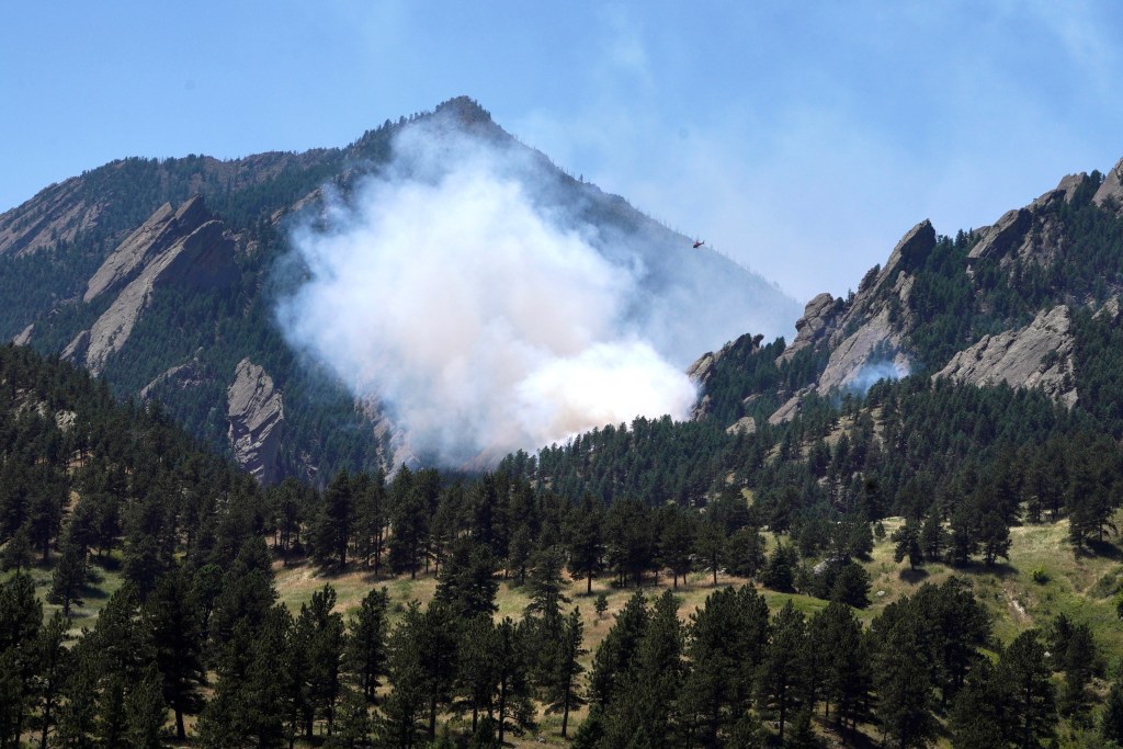
2:44 p.m.: “The fire is estimated at 3.5 acres and remains slow moving,” Boulder Office of Disaster Management said in a 2:30 p.m. update, noting that more than 75 firefighters are on scene with two helicopters “actively dropping water on the fire.”
2:20 p.m.: Despite high heat and low humidity in the Boulder area, weak winds could limit the spread of the fire, according to the National Weather Service.
Under-15-mph winds flowing northeast are expected through Friday afternoon, potentially limiting the spread of the Dinosaur fire eastward, NWS forecasters said.
2 p.m.: At 1:35 p.m., the Boulder Office of Disaster Management issued an advisory for areas southwest of Boulder to “be aware of your surroundings at all times.”
“While there are no evacuation orders for the Dinosaur Fire at this time, those who require extra time or have to transport medical equipment should begin making preparation plans now,” fire officials said in the advisory.
The fire is burning west of the U.S. National Center for Atmospheric Research, and all areas around NCAR are included in the advisory, fire officials said.
Previous reporting:
A wildfire that crews have called the Dinosaur fire is burning southwest of Boulder on federal property Friday afternoon, according to fire officials.
Kim Sorkiness, who was hiking in the area Friday morning, said she had passed through the area minutes before the flames started.
“I stopped to give my dog water further up the trail, and when I turned around I was like, ‘Oh my goodness, there’s a huge fire right there. That’s crazy,’” she said.
Sorkiness said she was taking photos in the area. One photo, from 11:19 a.m., shows no flames, she said. Less than 10 minutes later, a photo from 11:26 a.m. shows a huge fire.
“I was videoing it for a few minutes when I saw the huge flames, but then it got really windy and I started running away,” she said. “It seemed like it was spreading and moving really fast.”
Fire crews from multiple agencies were en route to the flames — in the Mallory Cave hiking area near the Boulder Flatirons — around 11:45 a.m., Mountain View Fire Rescue said in a statement on social media.
The fire is burning on U.S. National Center for Atmospheric Research land — a research center located 5 miles south of Boulder atop the 565-acre Table Mesa and funded by the National Science Foundation.
At 1 p.m., park rangers estimated the fire was burning on 2 to 5 acres of land behind NCAR, Sorkiness said.
Update on the fire near Boulder. Helicopters and tankers are dropping fire retardant and water. @denverpost pic.twitter.com/PbfzTY8vd9
— Zach Spindler-Krage (@zspindlerkrage) July 12, 2024
“At this point, no structures appear to be threatened,” fire officials said in the statement. “Please avoid the area to allow firefighters to get to work.”
The Colorado Department of Public Health and Environment has issued an air quality health alert for the southeastern area of Boulder County through 9 a.m. Saturday.
Three air teams joined fire crews on scene around 12:55 p.m. to fight the flames, dropping fire retardant and water on the fire, according to the Boulder Office of Disaster Management.
The office said that despite the quick start, the fire is slow-moving at this time.
As of 12:40 p.m., there were no reported injuries or evacuations, and all the trails in the area were closed, according to the Boulder Police Department.
Sorkiness said she saw the smoke turn from white before the sky suddenly filled with heavy, black smoke.
White smoke from a wildfire usually indicates the early stages of the flames as increased heat creates steam, according to BME Fire Trucks. Once that initial moisture is gone, the smoke color changes based on what the flames are burning.
This is a developing story and will be updated.
Originally Published: