


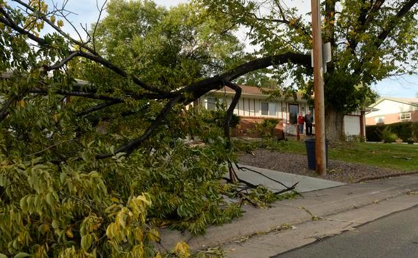
Metro Denver and Colorado’s Front Range will be buffeted by extreme winds Saturday that threaten power outages as well as property and tree damage, and pose a high risk of fueling wildfires, the National Weather Service warned.
As of Saturday morning, maximum gusts were expected to be in the 60 mph to 65 mph range in Denver, the 75 mph to 80 mph range in the foothills west of the city, and the 80 mph to 85 mph range in the Boulder and Estes Park areas, according to NWS forecasters.
The full magnitude of the winds will depend on the track of the incoming storm, forecasters wrote on social media, but there remains “some threat of 100 mph winds in/near the Front Range foothills.”
Xcel Energy warned that it will preemptively cut power to residents in parts of Boulder, Gilpin, Larimer, Douglas, Broomfield and Jefferson counties due to the extremely high wildfire risk. Xcel is facing hundreds of lawsuits after investigators concluded one of the company’s powerlines helped spark the wind-driven Marshall fire in Boulder County in 2021; the utility has disputed that conclusion.
Saturday’s winds are expected to develop throughout the day, strengthening through the night and lasting into Sunday afternoon, forecasters said.
As of 12:45 p.m., the peak gust logged by NWS meteorologists was 81 mph in the Indian Peaks Wilderness in north central Colorado, with several other Front Range gusts reaching 65 to 75 mph. Wind speeds in Denver were hovering the mid to low-40s.
“We’ve only just begun,” the weather service stated.
The areas NWS officials expect to be impacted include the foothills, the Interstate 25 corridor and all of the Eastern Plains.
High winds could bring about highway safety closures and restrictions, according to the Colorado Department of Transportation.
As of 1:30 p.m., Interstate 25 was closed at Wellington in northern Colorado — 5 miles north of Fort Collins — to all high profile vehicles and light trailers, according to CDOT.
Huerfano and Las Animas counties issued their own high wind restrictions Saturday afternoon, banning travel for all high profile vehicles and light trailers in the counties. Drivers could be ticketed for ignoring the restriction.
Blowing snow is expected in the mountains on Saturday, and NWS forecasters say snow showers also are likely in metro Denver in the morning and afternoon — though no accumulation is expected. Highs in the Denver area are forecast to reach the upper 40s on Saturday.
In the mountains, there’s a winter weather advisory in place through 6 a.m. Sunday due to blowing and drifting snow. Poor travel conditions are expected along the Interstate 70 corridor through the mountains, NWS forecasters warned.
On the eastern side of the state, blowing dust presents the same issue, according to NWS meteorologists. Drivers should be prepared for rapid changes in visibility on the eastern plains.
The winds will continue into Sunday, but it will also be warmer, with temperatures expected to reach the upper 50s. Northwest winds should continue in the 20 mph to 30 mph range on Sunday, with gusts up to 45 mph before the windstorm dies down.
Get more Colorado news by signing up for our daily Your Morning Dozen email newsletter.